- EBC Home
- Subjects
- Index
- About the EBC
- Using the EBC
- Maps
- Feature Articles
- Videos
- BC Facts
- For Teachers
- French Language Resources
- Books about BC
- BC Links
![]()
![]()
Glaciation
GLACIATION occurred in BC over a period, known as the Pleistocene, that lasted for about 2 million years. Then, as now, the earth experienced alternating warming and cooling trends. During the colder periods, great glaciers covered BC, grinding out valleys, sculpting the mountains and bulldozing large amounts of sediment. The last major glaciation, known as the Fraser Glaciation, began about 25,000–30,000 years ago and reached its maximum extent about 14,000 years ago when the Cordilleran Ice Sheet (see CORDILLERA) covered most of BC to a thickness of 2 km. (The northeast corner of the province was covered by the separate Keewatin Ice Sheet that spread west from Hudson's Bay.) Only the highest peaks were ice-free; these are called nunataks. The QUEEN CHARLOTTE ISLANDS and VANCOUVER ISLAND may have developed their own ice caps that merged with the main ice sheet for different lengths of time. The final ice age ended quite quickly; by about 10,000 years ago the glaciers had withdrawn from the lower elevations, allowing the recolonization of BC by plants and animals. The ice was very heavy and compressed the land beneath it. When it melted, sea water inundated the coastal plain, inlets and river valleys, and rose in some places at least 200 m above what it is today. Slowly the land rebounded and as it did, the sea withdrew to present levels. Remnants of the last great glaciation are visible in mountain icefields at several locations around the province, such as the Homathko Icefield near Mt WADDINGTON, the Iskut Icefield south of the lower STIKINE R, the Llewellyn Icefield west of ATLIN LK and the Columbia Icefield in the ROCKY MTS, straddling the BC–Alberta border south of Jasper. Other evidence of glaciation on the landscape includes characteristic U-shaped valleys, alpine cirques, coastal FJORDS, drumlins, eskers, pothole lakes, striations on exposed bedrock and ground moraines. In the mid-15th century alpine icefields began advancing again during a cooling episode that has been called the Little Ice Age. This continent-wide trend lasted until about 1850, when average temperatures once again began to rise. Much more recently the warming trend has accelerated dramatically; Sentinel Glacier in GARIBALDI PROVINCIAL PARK, for example, decreased in area by 10% between 1965 and 1992. A few areas in BC are believed to have escaped the last major glaciation; these are called glacial refugia. One notable glacial refugium is at BROOKS PENINSULA PROVINCIAL PARK, on the northwestern side of Vancouver Island, where elevations above 600 m were likely untouched by glacial periods over the last 25,000 years, making possible the existence of rare species. On a much more localized scale are nunataks, which are mountain peaks that protruded above glaciers and icesheets and so were not subject to the typical alpine erosion effects of glaciers.
-
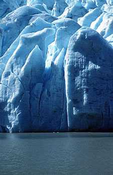
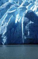 Bear Glacier near Stewart. Bernie Pawlik/Image Makers
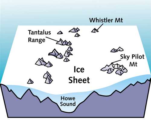
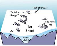 Howe Sound 15,000 years ago, covered by 7,000 feet of ice. Kim LaFave illustration