- EBC Home
- Subjects
- Index
- About the EBC
- Using the EBC
- Maps
- Feature Articles
- Videos
- BC Facts
- For Teachers
- French Language Resources
- Books about BC
- BC Links
![]()
![]()
Oceanography
OCEANOGRAPHY is a discipline that applies the basic principles of biology, chemistry, geology and physics to the study of oceans. The oceanography of the BC coast is complex and only partially understood because studies only began in the early 1950s when pioneer researchers such as J.P. TULLY started their work. The water characteristics on the West Coast, such as temperature, salinity, dissolved oxygen, currents and waves, are influenced by distant events. The mild climate is influenced by the relatively warm waters of the sub-arctic current originating in the western Pacific off Japan. This current flows toward BC through the Gulf of Alaska, transporting millions of cubic metres of water toward the coast every day. Another distant influence is the EL NIÑO phenomenon, which originates near the equator and periodically brings warm water and wet, mild winters from the south. TSUNAMIS are huge waves that may be produced by undersea EARTHQUAKES thousands of kilometres away. The Alaska earthquake in 1964 generated a major tsunami in the N Pacific that reached a height of 2.5 m in ALBERNI INLET, causing extensive damage. Another important determinant of water conditions on the coast, river runoff, is generated closer to home. The discharge from the FRASER R, for example, has a major impact on the oceanography of GEORGIA STRAIT, as water from the river lowers the amount of salt in the surface layer of the ocean. A similar effect is found around the mouths of the SKEENA and other large rivers.
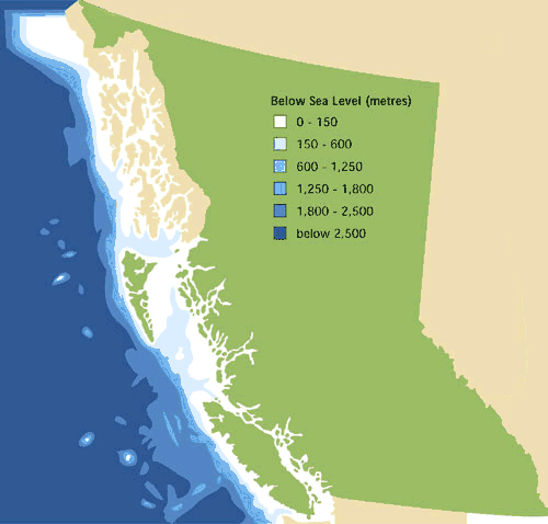
There are several major oceanographic regions in BC, including Georgia Strait, the continental shelf off the west coast of VANCOUVER ISLAND and the QUEEN CHARLOTTE ISLANDS, and the mainland FJORDS. The deep water west of the continental shelf lies within Canada's Exclusive Economic Zone extending 200 km from land. At an average width of 45 km, the continental shelf off BC is narrow relative to others around the world; in comparison, the shelf off Nova Scotia is over 185 km wide. Biological oceanographers recognize it as a very productive region because upwelling (movement of cold deep ocean water to surface layers) brings water rich in nutrients, such as nitrogen and phosphorus, close to the surface where tiny floating marine plants and animals, called phytoplankton and zooplankton, thrive. Phytoplankton are the foundation of the food chain in the ocean and are vital for ocean ecosystems. In the deep water (over 1,000 m) west of the continental shelf, BC oceanographers have discovered undersea volcanoes known as black smokers, where hot water from under the earth's crust is escaping and bringing minerals onto the deep sea floor and overlying water. These black smokers are associated with a unique community of animals, such as giant red worms and CLAMS that are adapted to the darkness, cold temperatures and high pressure of deep-sea conditions.
The shoreline of BC, including all the large and small ISLANDS, fjords and bays, is 27,200 km long, one of the longest in the world governed by a single jurisdiction. Stretched out, it would equal about two-thirds of the earth's circumference at the equator. The fjords were created by glaciers that covered almost all of BC up until about 10,000 years ago (see GLACIATION). As they pushed seaward, the ice masses carved deep gouges in the earth, which then filled with ocean water as the ice melted. Some of the fjords are extremely deep; for example, part of JERVIS INLET is 600 m deep, and HOWE SOUND at BRITANNIA is almost 300 m deep. The fjords bring ocean conditions far inland. BELLA COOLA, for example, is at the head of a long system of fjords more than 100 km from the open sea, and PORT ALBERNI is at the head of a fjord that nearly bisects Vancouver Island. Some of the fjords have unique features of interest to chemical oceanographers, such as SAANICH INLET. Because the deep water in this inlet is only occasionally replaced by new ocean water from off the coast, dissolved oxygen, which marine plants and animals need to live, is almost totally missing. In other fjords, such as Howe Sound, the dissolved oxygen is usually replaced each year. In both cases oceanographers are concerned about disposal of waste material because some waste (wood waste from LOG BOOMING or PULP mills) uses up dissolved oxygen as it decomposes.
Tidal currents along the BC shoreline are among the swiftest in the world, making passages such as SEYMOUR NARROWS near CAMPBELL RIVER tricky to navigate. The tremendous currents at SKOOKUMCHUCK RAPIDS near EGMONT on the SUNSHINE COAST can reach almost 30 km per hour; the earth shakes when these currents are at their maximum strength during spring TIDES.
Biological oceanography is very important to coastal communities because marine ecosystems support all fish populations, including SALMON, HERRING, ROCKFISH, clams, OYSTERS and thousands of other species. Changes in oceanography can result in major differences in marine ecosystems. For example, during El Niño years, when warm water arrives from the south, predatory MACKEREL can move into our region along with it and eat the juvenile salmon. Recreational divers enjoy looking at the diverse species of marine invertebrates that are abundant in tidally swept areas such as Seymour Narrows. Indeed, the clear waters of northern Georgia Strait are sometimes called the "Emerald Sea." In these areas there is an abundance of filter-feeding animals, such as SPONGES, SEA ANEMONES and certain SEA CUCUMBERS that thrive on the food particles brought to them by tidal currents (see also BIODIVERSITY; NATURAL HISTORY). The deep inlets on the North Coast (such as at GRENVILLE CHANNEL near PRINCE RUPERT) are also tidally swept and support diverse animal and plant communities.
by Colin Levings