- About KnowBC
- Terms of Use
- Searching KnowBC
- BC Facts
- Books about BC
- BC Links
- For Teachers
- Connect to KnowBC FAQ
![]()
![]()
Thompson River
THOMPSON RIVER, the longest tributary of the FRASER R, drains a 55,827.84 sq km watershed in central BC. It consists of 2 branches. The N Thompson (365 km) rises in the CARIBOO MTS east of WELLS GRAY PROVINCIAL PARK and flows southerly through wooded country to KAMLOOPS. For most of this distance the CNR and Hwy 5 run parallel to it. At Kamloops the north branch merges with the S Thompson (161 km) flowing in from SHUSWAP LK on the east and the combined river flows west from Kamloops Lk through...
If you are already registered on KnowBC, login now to get access to the full article.
You may already have access to KnowBC through your school, university or library.
- Schools that subscribe to KnowBC
- Colleges and universities that subscribe to KnowBC
- Public libraries that subscribe to KnowBC
If you do not already have access to KnowBC, you can subscribe.
-
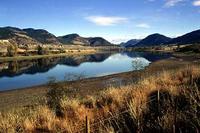 S Thompson River. Bernie Pawlik/Image Makers
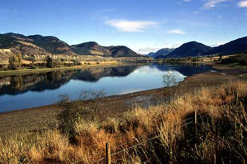
Copyright 2001-2025 Harbour Publishing